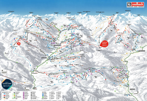
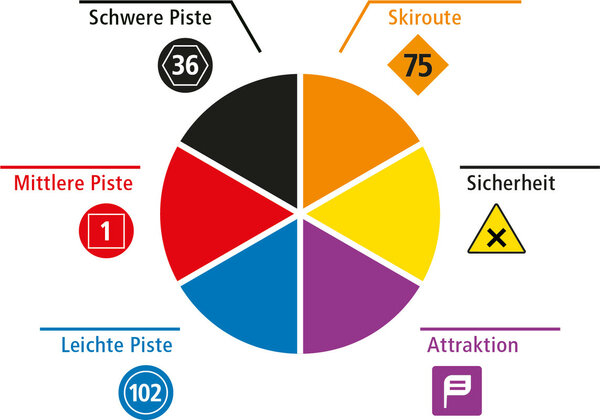
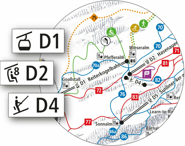
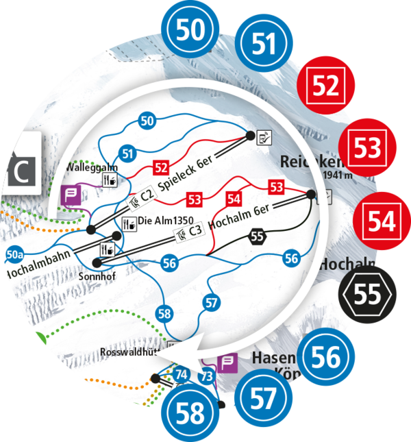
THE NEW SLOPE GUIDING SYSTEM

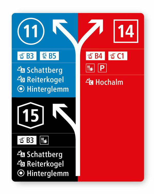
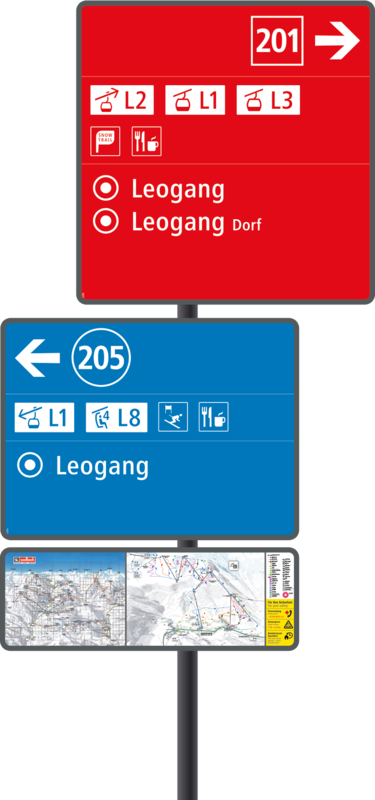
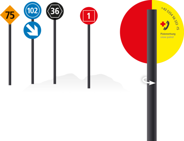
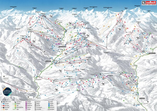
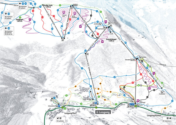
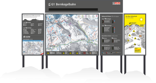
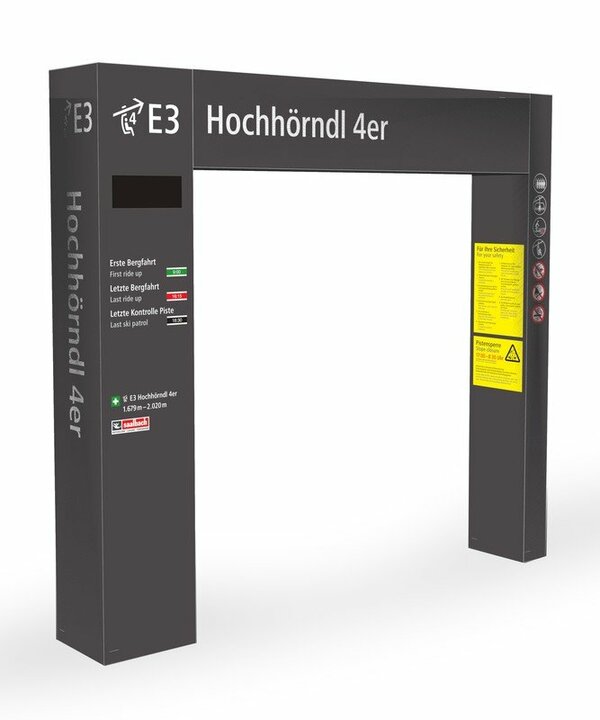
Reinventing a slope guidance system from scratch for such a large and varied ski area as the SKICIRCUS Saalbach Hinterglemm Leogang Fieberbrunn is a mammoth task. But those who aspire to be exemplary in terms of orientation, safety and system uniformity must lead the way.  That's why the Skicircus underwent an extensive design process. Since winter 2019/20, the new piste guidance system has ensured even better progress in the Skicircus.

Everything figured out: Key elements and updates 

1. Ten alphanumeric ski area zones: laid out clockwise across the ski area.
2. Alphanumeric station designation
3. Zone panorama: clear zone boards with all details on the mountain (at exits)
4. Overall panorama boards at the valley stations
5. Colors and shapes for difficulty levels, safety, attractions... barrier-free
6. Wayfinding signs: Pre-announcer and turn-off signs with panoramic panels.
7. Slope markers: with emergency phone number on the back side
8. Portals at the lift entrances: One-stop information at the lift entrance

The whole Skicircus in 10 Zones. Arranged clockwise. Nothing to it. 


10 alphanumerical zones and their mountain names reveal the big picture. Positioned in a clockwise manner around the main locations, they offer a clear, central orientation.


Zone A - Schattberg
Zone B- Zwölferkogel
Zone C - Hochalm
Zone D - Reiterkogel
Zone E - Reckmoos
Zone F - Streuböden
Zone G - Bernkogel
Zone H - Kohlmais
Zone I - Schönleiten
Zone L - Asitz

Simple colour-code system. Based on symbols, accessible for all.


6 colours are all that are needed to convey all the relevant information on the go. The three difficulty levels have each been allocated a shape (circle, square, hexagon). This means that the difficulty level of a slope can be easily recognised, even with poor visibility or impaired colour perception. 

4 shapes speak clearly, even without colour coding.

 Alphanumeric codes & everything makes sense


Straight forward pictograms (lift type) and alphanumeric codes (zone/detailed zone) enable clear labelling of the lifts and ski area zones. The slopes are (like the zones) numbered in a clockwise manner and are therefore easy to distinguish on the panoramas and maps.

Systematic signposts. On the go, the way is clear. 


Just like a traffic control system, we highlight approaching turn-offs with warning signs. Turn-off signs are then positioned at the junctions. Both types of sign contain the relevant information for the turn-off.


All signposts indicate the difficulty level with their background colour.

In addition, panorama maps (general panoramas and detailed panoramas) are attached to many turn-off signposts to help with reorientation.


Along the slope: orientation, again and again.

The slope markings show that you are on the right track. And in case of emergency, emergency numbers are written on the back.

General and detailes panoramas. 


At the base stations there are large general panoramas and at the top stations there are zone panoramas. Guests can get a focused view of the slopes before them before embarking on their descent.

Panorama boards. The source of all information. 


As well as the usual information, at numerous locations there is now an infrastructure module, which lists all highlights of the zone, including nearby huts.
If required, there is now also a safety module that shows the most important safety topics in an easily understandable way.

Portales at lift entrances. Important information in passing. 


At the lift entrances there are grey portals with the key information for skiing fun: a one-stop information point with lift names, operating times, the time, safety information, skiing routes,...